|
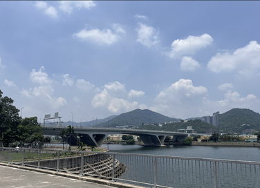
Route Starting from Tai Po Market Railway Station, heading south along the Tolo Harbour coastline, you can enjoy the beautiful scenery. As you continue forward, passing through the Science Park, the Chinese University of Hong Kong, and crossing the famous Twin Bridge, you will reach the Ma On Shan Promenade.
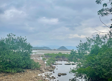
Walking north along the Ma On Shan Promenade, you will pass by Ma On Shan Park and Wu Kai Sha Pebbles Beach. Here, you can take a moment to slow down and admire the captivating sea views from the observation deck in the park or from the beach. Next, you will encounter two sites of special scientific value, namely the Nai Chung Beach and the mangroves of Kei Ling Ha. Their rich biodiversity is worth pausing to appreciate. At this point, you have entered the Sai Kung District, often referred to as the "Back Garden of Hong Kong." After passing through Shui Long Wo and Yung Shue O, you will embark on a hiking journey along the hillside trail. Along the way, you can look back and appreciate the sea view of Kei Ling Ha or pay attention to the stream flowing beneath your feet, fully immersing yourself in nature. After passing Wong Shek Pier and To Kwa Peng, you will reach Section 2 of the MacLehose Trail. Within this section, you will pass by several popular camping spots, such as Chek Kang and Ham Tin Wan; as well as beaches like Sai Wan and Long Ke. Next, you will arrive at the East Dam of High Island Reservoir, signifying the starting point of Section 1 of the MacLehose Trail. Within this section, you can appreciate the natural landscapes within the Hong Kong UNESCO Global Geopark and encircle the High Island Reservoir before reaching Pak Tam Chung. Walking west along Tai Mong Tsai Road will lead you to the Sai Kung town center. From here, you will continue along Hiram’s Highway, passing through places like Pak Sha Wan, Lo So Shing Beach, and Pak Shui Wo, until you reach the Hong Kong University of Science and Technology. Continuing along Clear Water Bay Road, you will be able to enjoy views of Ngau Mei Hoi and the distant mountains of the Sai Kung Country Park. Next, you will arrive at Tai Au Mun, exploring the Clear Water Bay Country Park by taking the Lobster Bay Trail. After crossing High Junk Peak, you will reach Tseung Kwan O, marking the end point of this 90-kilometer journey. |
路線 從大埔墟鐵路站出發,沿著吐露港海岸南行,可以欣賞到秀麗的風景。一直前行,經過科學園、香港中文大學和跨過著名的雙子橋後,便會到達馬鞍山海濱長廊。
沿著馬鞍山海濱長廊往北走將經過馬鞍山公園及烏溪沙沙灘,在此能夠稍微放慢腳步,到公園內的觀景台或沙灘觀看迷人的海景。緊接經過兩個具特殊科學價值地點:泥涌海灘及企嶺下紅樹林。其豐富的生物多樣性值得您停下腳步細心欣賞。之後將進入了被譽爲「香港後花園」的西貢區。 經過水浪窩及榕樹澳後,沿著嶂上郊遊徑開始一段登山之旅。沿路上可以看見企嶺下海的景色,或留意在腳下流過的小溪,盡情享受大自然。在經過黃石碼頭及土瓜坪後,您將到達麥理浩徑第二段。在這一段路程中,將經過幾個露營熱門地點包括赤徑、鹹田灣、大浪西灣、浪茄等。到達萬宜水庫的東壩,也代表著已到達麥理浩徑第一段。在此段您能欣賞香港聯合國教科文組織世界地質公園內的天然地貌及圍繞萬宜水庫一圈,並到達北潭涌。沿著大網仔路往西走便可到達西貢市中心。 從這裡開始,沿西貢公路走,經過白沙灣、露營灣及白水碗等地後,將到達香港科技大學。再沿清水灣道走,沿途上您能夠欣賞牛尾海及遠眺西貢郊野公園的山景。接著,您將到達大拗門,經龍蝦灣郊遊徑圍繞清水灣郊野公園一圈。在跨過釣魚翁後便會到達將軍澳,也是這段90公里旅程的終點。 |
CoastalTrail.hk
Initiators
Supporting Organizations
|
Phone and Fax 電話及傳真:
T: 3104 2767 F: 2187 2305 |
Address 地址:
21/F, Chun Wo Commercial Centre 25 Wing Wo Street, Central |


