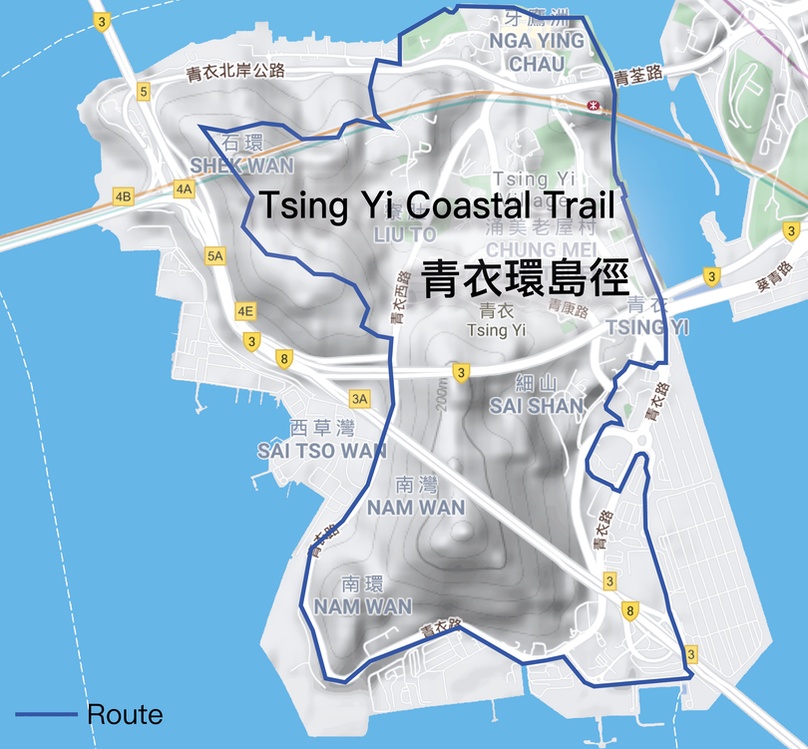
RouteFrom the Maritime Square, walk along the Tsing Yi Promenade, we can take a look at the Rambler Channel Typhoon Shelter. Arriving at the Tsing Yi Promenade and Cheung Fai Road, we can overlook the Public Cargo Working Area. Afterwards, go straight and pass through the Tsing Yi Swimming Pool and Tsing Yi Pier. The former Tsing Yi Public Pier was once provided ferry service, but the traffic has gradually improved, and the route has been suspended. Passing through the Cheung Tsing Bridge and Tsing Yi South Bridge, it will soon arrive at the industrial hubs, including shipyards, docks and oil depots.
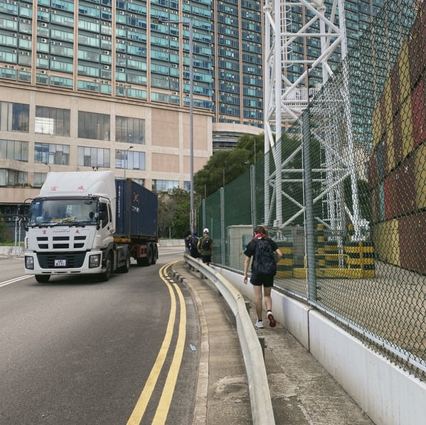
Walk up along Tsing Yi Road and Tsing Yi Hong Wan Road, it will soon pass through the Hong Kong International Terminals and the Kwai Tsing Container Terminal 9, as well as the bottom of the Stonecutters' Bridge. The container terminals are located under the intersection of Tsing Yi Hong Wan Road and Tsing Sheung Road, go towards and we can overlook the scenery of the West Lamma Channel. Would you like to take some pictures under the Stonecutters’ Bridge or the container crane? You can even go to the end of Tsing Sheung Road, and discover more about the terminals. Following up to the oil depots nearby, you can see the Sinopec Hong Kong Oil Terminal, which is a giant circular oil depot that is rarely seen in urban areas. The three-fold mountains at the back are known as the highest point of Tsing Yi Island. Apart from the oil depots, are you interested in the city's ruins? Walk along Tsing Yi Road, and turn into Nam Wan, the Swire Paint Factory is found on the right hand side. Reaching Sai Tso Wan, walking along Tsing Sha Highway and oil depots, it will soon pass through the KMB Tsing Yi Bus Depot. Tsing Yi South is a special cluster of oil and gas storage in Hong Kong. Currently, the five largest oil depots in Hong Kong are all located in Tsing Yi. Pass through the junction of Nam Wan Tunnel and Cheung Tsing Tunnel when entering the Tsing Yi West Road, we can directly turn into the Tsing Yi Nature Trail. After reaching the top of the Tsing Yi Nature Trail, we can take a look at the fine panoramic view, as well as to enjoy its sunset and night scenery. The nature trail is mostly designed for the elderly and children, all beginners are able to reach the top too! Through Fong Tin Mei Path, pass through Tam Kon Shan Road, it will soon arrive at the Tsing Yi Northeast Park. Afterward, go straight to the park, and walk along the grass pitches and football fields, we can return to the Tsing Yi Promenade. From the Tsing Yi Promenade, we have completed the 16km Tsing Yi Coastal Trail. |
路線從青衣城出發,沿著青衣海濱長廊,可欣賞藍巴勒海峽的景色,一直前行,經過青衣游泳池便到達青衣碼頭。昔日的青衣碼頭曾提供客輪服務,隨著島上的跨海大橋落成,島上陸路交通改善,航線已停航多年。經過長青橋及青衣南橋底,便準備踏入青衣的工業地帶。
向南面走,經污水處理廠旁的電梯短暫回到青衣路,再緩緩走下青鴻路遊樂場旁的小徑,前往青衣航運路。沿經香港國際貨櫃碼頭和九號貨櫃碼頭,就會穿過昂船洲大橋橋底。走到青尚路的盡頭更可以一睹昂船洲大橋及貨櫃碼頭的風景。跟著青衣路旁的油庫一直走,在步近中石化香港油庫時,更可以看到市區少見的巨型圓形油庫。 身後三度高低起伏的山形,就是青衣島的最高點「三支香」。在青衣路沿途會看到不同種類的工業活動,轉入南環的路段時,更有一座廢棄的工廠,它就是太古漆廠的舊址。其後到達西草灣一帶,沿青衣西路緩緩上斜,便可經過南灣隧道和長青隧道的出口,並可從高處遠眺西草灣一帶的重工業。 再向前行就會到達青衣自然徑的入口。在青衣自然徑登頂後,即可將大橋景色盡收眼簾,於黃昏時登上頂點更可欣賞青馬大橋日落夜景。在長宏邨巴士總站旁轉入芳田美徑,於担杆山路直行,便到達青衣東北公園。穿過公園重回青衣的海濱,一路沿岸邊走到便回到青衣海濱長廊,途經青荃橋橋底,便回到我們的起點。 |